Airbus Sentinel-2C satellite is one step closer to launch
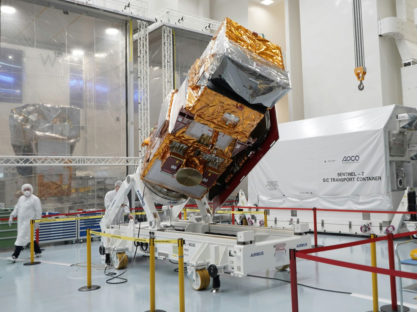
The Airbus-built Sentinel-2C satellite is about to set sail from Germany as it continues its journey to its launch site.
The satellite is the third Copernicus Sentinel-2 and is en route to the Guiana Space Centre in Kourou, where it is scheduled to arrive in about two weeks before a planned launch in September.
Once it is in orbit, it will collect data that can be used to monitor land use and change, soil sealing, land management, agriculture, forestry, natural disasters (floods, forest fires, landslides, volcanic eruptions and erosion) and to support humanitarian aid missions.
Environmental monitoring, which provides information on the pollution of lakes and coastal waters, is also part of these activities, as is the monitoring of glaciers, ice and snow.
Airbus head of earth observation, science and exploration Marc Steckling said: “About half of the data used to assess and monitor the impact of climate change on Earth is actually delivered by satellites.
“The Copernicus Sentinel-2 satellites have provided valuable climate information to scientists since 2015 and Sentinel-2C will ensure continuity.
“Additionally, they have also made monitoring marine litter from space a reality, a significant achievement considering how critical this issue has become.”
The Sentinel-2 mission contributes to the management of food security by providing information for the agricultural sector.
Copernicus Sentinel-2, with its multispectral instrument, is the first optical Earth observation mission of its kind to include three bands in the “red edge”, which provide key information on vegetation conditions.
The satellite is designed to provide images that can be used to distinguish between different crop types, as well as data on numerous plant indices such as leaf area index, leaf chlorophyll content and leaf water content – all of which are essential for accurately monitoring plant growth.
Sentinel-2C, like its predecessors Sentinel-2A and -2B, will provide “colour vision” for Copernicus, the Earth Observation component of the EU Space Programme, generating optical images from the visible to the shortwave infrared region of the electromagnetic spectrum.
From an altitude of 786 kilometres, the 1.1 tonne C satellite will provide continuous imaging in 13 spectral bands with resolutions of 10, 20 or 60 metres and a uniquely large swath width of 290 kilometres.
The optical design of the MultiSpectral Instrument (MSI) has been optimised to provide state-of-the-art image data quality over its very wide field of view, to be transmitted via Airbus’ laser-based SpaceDataHighway (EDRS).
The telescope structure and mirrors are made of Silicon Carbide, a material pioneered by Airbus to provide very high optical stability and minimise thermo-elastic deformation, resulting in excellent geometric image quality.
This is unprecedented in this category of optical imagers. Each Sentinel-2 satellite collects 1.5 terabytes per day after on-board compression.
The Sentinel-2 mission is based on a constellation of two identical satellites, Sentinel-2A (launched in 2015) and Sentinel-2B (launched in 2017), flying in the same orbit but 180° apart to optimise coverage and revisit time.
The satellites orbit the Earth every 100 minutes, covering all land surfaces, large islands, inland and coastal waters every five days.
Once in orbit, Sentinel-2C will replace its predecessor, Sentinel-2A, while Sentinel-2D will later replace Sentinel-2B to ensure continuity of data beyond 2035.
The Sentinel-2 mission has been made possible through close cooperation among the European Commission, ESA, industry, service providers and data users.
Some 60 companies have been involved in its development, led by Airbus Defence and Space in Germany.
Airbus has played a key role in building the satellites and instruments for Copernicus since the programme began in 1998, contributing its environmental expertise to all six Sentinel missions and the new next-generation Copernicus satellites: CRISTAL, LSTM and ROSE-L.
The Sentinel satellites are part of Copernicus, the Earth Observation component of the EU Space Programme, managed by the European Commission (EC) in partnership with the European Space Agency (ESA).
The Copernicus Sentinels provide remote sensing data of the Earth, providing key operational services related to the environment and security.
Pre-launch activities will be carried out in Kourou to prepare Copernicus Sentinel-2C for launch on the final Vega rocket operated by Arianespace in September.